After having explored our mountains and valleys on foot, by bicycle and canoe it was time to take a look at the Slocan Valley from the air.
It is a warm, sunny and cloudless day in September. Our airplane starts in Castlegar. We follow the run of Kootenay Lake’s West Arm before turning into Slocan Valley.
Slocan River flows deep below and we clearly see all the small islands we know from our canoe trips. The river meanders through meadows, cultivated farm land, and the small communities of Slocan Park and Winlaw. The few bridges make it easy to realize where we are. Highway 6, the main route through Slocan Valley is well visible.
It only takes a few minutes to reach Slocan City. The southern part of Slocan Lake lies in front of us. We clearly see the highway on the lake’s east side winding up to the bizarre bluffs with their steep slopes.
We turn to west into Valhalla Provincial Park. We want to follow our hiking traverses as much as possible from the air.
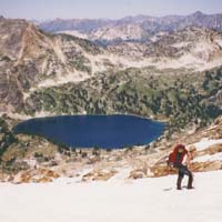
And then they are below us – the Valhalla mountains and peaks we know so well. We see some of the peaks we already have climbed. Gimli Peak, our “home peak” is easy to detect as well as the pyramid shaped Mount Asgard.
The northernmost
Demers Lake
We fly over Mulvey Basin and soon cross Valhalla Lake, Drinnon Pass and the Gwillim Lakes in the western part of the park. Then we turn north and try to orientate ourselves despite the unfamiliar perspective. We pass Demers Lakes. What only takes a few minutes in an airplane requires a strenuous 3-day-hike with numerous ups and downs.
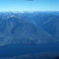
View east over Slocan Lake
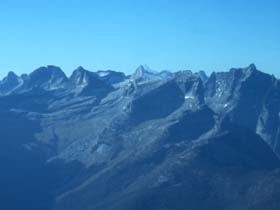
on the glaciers of Kokanee Glacier Provincial Park
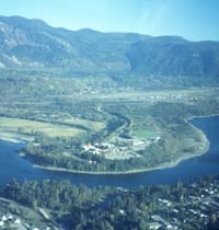
Castlegar am Columbia River
|
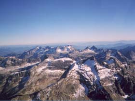
Valhalla Mountain Ranges
Gimli - Asgard - Robertson Peak
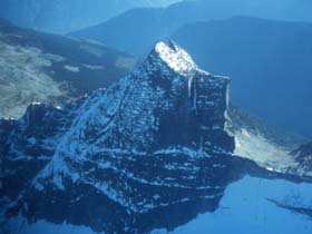
Gimli Peak from Mulvey Basin - site
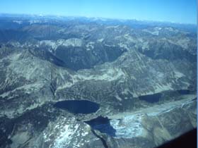
Demers Lakes
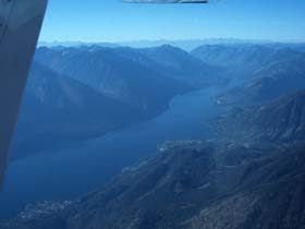
Slocan Lake with Silverton and New Denver
We meet Slocan Lake from its west side. Kokanee Glacier Park in the east with its ice fields is clearly visible. We circle around Idaho Peak, see Silverton, New Denver and Rosebery below us. We follow Slocan Lake southward on our way back to Castlegar, fly over Slocan City and again follow Slcoan River and its way through Slocan Valley.
And suddenly we see the confluence of Lemon Creek and Slocan River where we live. We realize the unspoiled and natural landscape with the river side arms and beaver islands right at our backdoor. But the high trees make it impossible to see our houses. But nevertheless it’s an unparalleled and unforgotten experience. Helicopter and small airplane flights are offered from Castlegar and Nelson.
Elisabeth von Ah
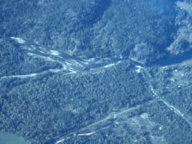
Lemon Creek Mündungsgebiet
in den Slocan River
|